Imagine this: it’s past midnight, you step outside, hold your phone up to the dark Colorado sky — and right there, overlaid on the camera feed, a reticle locks onto a moving point of light. Altitude: 408 km. Speed: 7.66 km/s. Mission elapsed time ticking up in real time. That’s not a satellite. That’s Artemis II — the first crewed lunar mission in over fifty years — and you’re watching it live from your backyard.
That’s the experience I built with Space TrackAR.
What Is It?
Space TrackAR is a Progressive Web App — no App Store, no install, no friction. You open it in your browser, grant camera and location access, and point your phone at the sky. The app overlays real-time spacecraft data directly on your camera feed using augmented reality: position, altitude, azimuth, distance from Earth, orbital speed, and mission elapsed time, all rendered in a clean heads-up display.
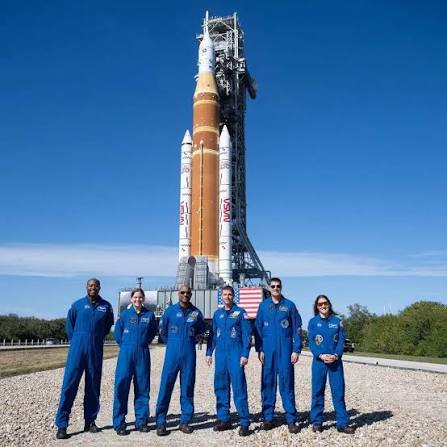
Right now it tracks Artemis II, NASA’s first crewed Artemis mission — the one that puts humans on a lunar flyby trajectory for the first time since Apollo 17. We’re talking about a genuine milestone in human exploration, and you can watch it happen in your own sky.
👉 Try it now at space-trackar.hughiedevore.com
How to Use It
Dead simple. Open the link on your phone, hit Allow when it asks for camera and location, then step outside and sweep the sky. The AR overlay calculates where Artemis II is relative to your GPS coordinates and device orientation in real time. When the spacecraft rises above your horizon, the reticle appears in your viewfinder. You can see exactly where to look — no astronomy degree required.
It works best at night with a clear sky, but the data updates continuously regardless. Even indoors you can watch the mission stats tick: distance from Earth, current speed, how long the crew has been in transit.
The Tech (Without the Dry Stuff)
Under the hood, Space TrackAR pulls real ephemeris data from NASA’s JPL Horizons API — the same system professional astronomers use to calculate precise spacecraft trajectories. That’s not simulated position data. That’s where the spacecraft actually is, computed from orbital mechanics.
The app is built with Vite + TypeScript and renders the AR overlay with the Canvas 2D API — no native app, no WebXR dependency, just a fast, installable PWA that runs anywhere. Your device’s orientation sensors and GPS feed into the math that figures out exactly where in your sky to point the reticle. It’s genuinely cool to feel the pieces come together: real trajectory data, real sky coordinates, real camera — all in one view.
Why I Built It
I’m drawn to tools that make invisible things visible — that collapse the distance between people and concepts they’d otherwise never encounter directly. Most folks will never see a spacecraft with their naked eye and know what they’re looking at. This changes that. You don’t need a telescope. You don’t need to read a launch manifest. You just hold up your phone and the universe gets a little smaller.
There’s also something that feels right about building this now. We’re in a golden age of space exploration — Artemis, commercial crew, Mars ambitions — and the tools to engage with it should be as accessible as a browser tab. Space isn’t just for aerospace engineers and government agencies anymore. It belongs to all of us.
What’s Next: The Bigger Vision
The name Space TrackAR is intentional. Artemis II is the beginning, not the ceiling. The roadmap includes tracking the ISS, Starship missions, active satellites, and eventually a full catalog of objects you can pin to the real sky from anywhere on Earth. Think of it as a living AR star map — but for human-made objects hurtling through orbit at thousands of miles per hour.
Every big thing starts with a single object tracked cleanly. This is that first step.
If you’re a space nerd, a developer curious about PWAs, or just someone who wants to feel the scale of what humanity is currently doing out there — go try it. Step outside tonight, point your phone up, and find Artemis.
The sky’s not the limit anymore. It’s just the beginning.